St. Lucia sits in the eastern Caribbean within the Windward Islands, between 60 and 61 degrees west longitude and 13 and 14 degrees north latitude.
Nearby islands help explain why its position mattered so much.
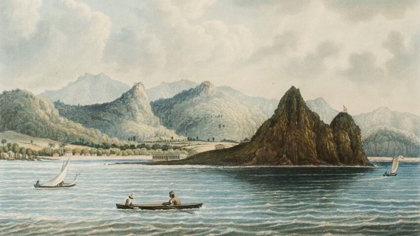
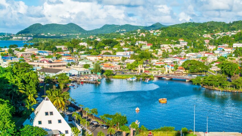
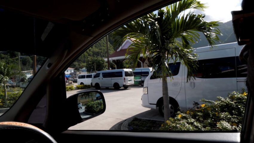
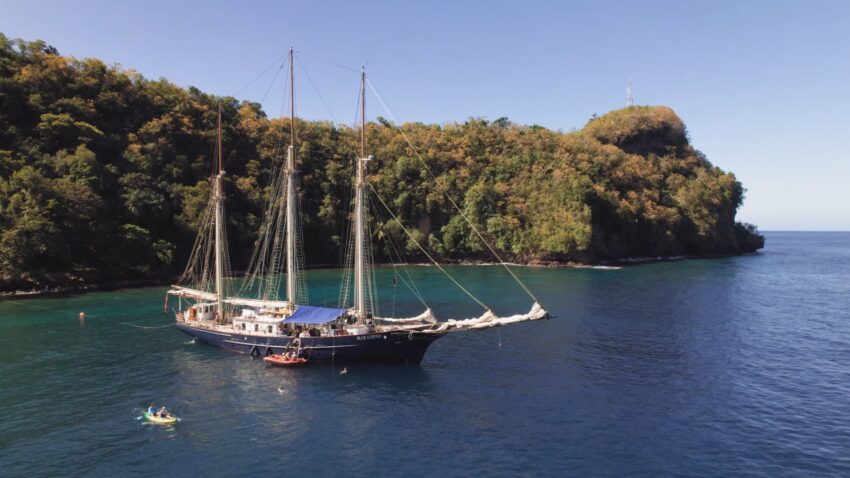
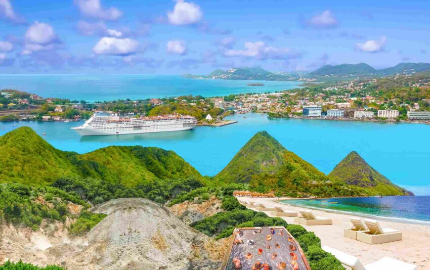
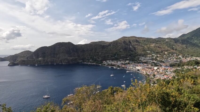
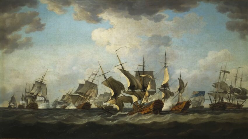
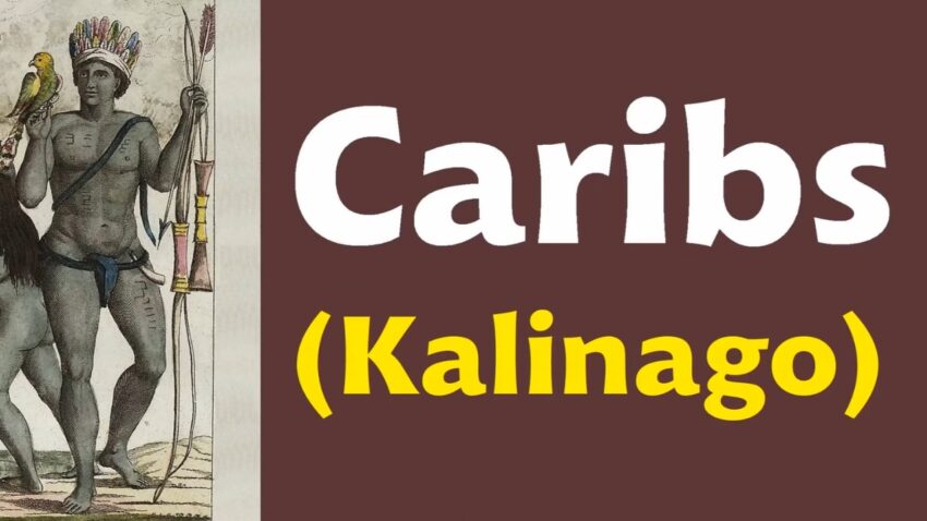
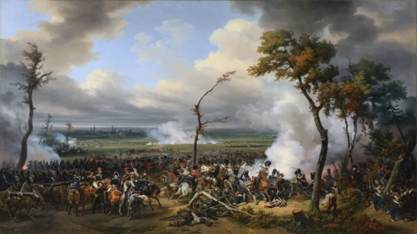
Surrounded by Caribbean Sea and Atlantic Ocean waters, St. Lucia occupied an important place for vessels moving through the region. Measured at 238 square miles, St. Lucia is about 27 miles long and roughly 14 miles wide at its midsection. Size alone did not determine its importance. Location did. European empires relied on sea routes to move soldiers, goods, sugar, supplies, and information. Control of islands helped control naval movement, trade lanes, and wartime staging areas. St. Lucia’s position near Martinique gave it extra value in the Anglo-French contest. One island could help watch, threaten, or defend nearby colonial holdings. Possession of St. Lucia meant more than a flag on a map. It meant better reach across waters used by merchant ships and warships alike. Long before France and Britain fought for St. Lucia, Amerindian communities, also known as the Kalinago, lived on the island for about 800 years. Early European settlement was difficult because Kalinago resistance limited outside control. St. Lucia was not an empty prize waiting for empires. It was already home to people who defended their land and complicated European plans. Names tied to St. Lucia’s early history show how different peoples described the island over time. Before St. Lucia became a French and British prize, it was already contested ground. Early European efforts faced Indigenous resistance, difficult terrain, and settlement dangers in a region already shaped by local power. In 1659, English forces arrived and tried to take control. England claimed a right to St. Lucia because of an earlier colonization attempt. That claim failed, and English forces were eventually defeated. That year marked the beginning of a long imperial tug-of-war. For roughly 150 years, France and Britain contested St. Lucia again and again. Pride alone did not explain the struggle. Each side knew St. Lucia could affect military planning far outside its own shores. Castries and Morne Fortune show why St. Lucia mattered. Morne Fortune rises behind Castries and looks over the harbor. A fort and cannons on that hill reveal the military logic behind repeated battles for the island. A fort above a harbor could protect ships below. Control of Castries allowed a power to watch and defend the naval traffic. High ground gave defenders an advantage against enemy fleets, landing parties, and artillery attacks. Marigot Bay offers another example. A British admiral once saved his ships against a French fleet by sailing into Marigot Bay and camouflaging the vessels with palm fronds. That episode shows how St. Lucia’s coves and bays could shape naval outcomes. Marigot Bay sits within the eastern Caribbean’s Windward Islands, adding to St. Lucia’s value as a maritime stop and shelter. At the southern end, Moule-a-Chique marks the area where Caribbean waters meet the Atlantic, tying the island to movement between major waters. St. Lucia was not only beautiful. It had military geography: harbors, hills, clear views toward sea routes, and access near the meeting point of Caribbean and Atlantic waters. St. Lucia’s history belongs to the broader rivalry between Britain and France. Control shifted as larger wars, treaties, and imperial fortunes changed. Often, St. Lucia was not only a local war aim. It also became a bargaining chip in global conflict. European wars across the Atlantic world affected who controlled Caribbean islands, especially those with good harbors and military positions. Nicknamed the “coveted Helen of the West,” St. Lucia became a symbol of repeated imperial pursuit. Fourteen changes of control show how local Caribbean history was tied to decisions made in European capitals and on Atlantic battlefields. St. Lucia’s story shows that even a small island could carry large diplomatic and military weight. A change in European power could alter Caribbean ownership, and a Caribbean harbor could affect European war planning. After roughly 160 years of alternating French and British control, St. Lucia continued under British rule between 1803 and 1967. In 1967, St. Lucia became a self-governing state. Independence came in 1979, while the country stayed within the Commonwealth. Modern political ties with Britain still matter, but they are not simple. Today, we proudly celebrate 47 years of freedom, resilience, and national pride. Under this year’s theme, “𝐃𝐨𝐮𝐯𝐚𝐧 𝐀𝐧𝐬𝐚𝐧𝐦; 𝐍𝐨𝐮𝐫𝐢𝐬𝐡𝐢𝐧𝐠 𝐎𝐮𝐫 𝐏𝐞𝐨𝐩𝐥𝐞, 𝐒𝐭𝐫𝐞𝐧𝐠𝐭𝐡𝐞𝐧𝐢𝐧𝐠 𝐎𝐮𝐫 𝐍𝐚𝐭𝐢𝐨𝐧,” Happy 47th Independence, Saint Lucia.#Independence🇱🇨 pic.twitter.com/fbpojXLkzI — Saint Lucia Government (@SaintLuciaGov) February 22, 2026 In 2026, St. Lucia had just turned 47 years old as an independent country. That milestone carried historical weight because Britain had once pursued control of the island across fourteen transfers of power. Colonial memory still affects modern debate. Recent criticism of British visa policy used St. Lucia’s colonial past as a frame, arguing that Britain once fought repeatedly to possess the island, yet modern policy can still create tension with Saint Lucians today. St. Lucia’s path after empire was shaped by that long contest. Colonial rivalry helped form its political route, while modern diplomacy shows that old imperial connections still carry meaning. St. Lucia was worth fighting over because it sat in an important eastern Caribbean position near French Martinique and British Caribbean interests. Its harbors, especially Castries and Marigot Bay, were useful for naval movement and shelter. Its high ground, especially Morne Fortune, gave defenders powerful views and artillery advantages. The southern end is connected to the movement near the Caribbean and Atlantic waters. Neither empire treated St. Lucia as a minor possession. Both powers returned to the island as wars, treaties, and imperial priorities shifted. St. Lucia’s past shows how a small island could become central to global imperial rivalry. It was fought over not simply because it was beautiful, but because it was well placed, militarily useful, and politically valuable.
Indigenous Resistance Before European Rule
French Settlement and British Challenge
France purchased St. Lucia in 1650 and settled on the island in 1651. French colonists slowly built their presence after resisting attacks by the Caribs.
Harbors, Fortified Heights, and Naval Usefulness
Caribbean Battleground of Empire
British Rule, Independence, and Modern Ties
Why St. Lucia Was Worth Fighting Over